Official Name:
二墩滩长城3段ErDunTanChangCheng3DuanOur Name:
/
Other Name:
/
Period:汉
/ Han Dynasty 206 B.C.~316A.D.
Location: 甘肃省,酒泉市,玉门市,起点:柳湖乡东北9.5千米处止点:柳湖乡西北9.95千米处 / GanSuSheng,JiuQuanShi,YuMenShi,QiDianLiuHuXiangDongBei95QianMiChuZhiDianLiuHuXiangXiBei995QianMiChu
[
Looking Local List]
Details:长城类别:墙体
起点经纬高度:东经:097° 37′ 北纬:40° 25′ 海拔:1249
终点经纬高度:东经:097° 35′ 北纬:40° 25′ 海拔:1257
墙体走向:该段长城总体走向为东南-西北,从第一自然段起点处(第0215点)始,墙体走向由原东-西走向拐向西偏北15°延伸。
墙体类别及构筑方式:墙体消失,构筑方式不详。
墙体类别:消失的长城
结构特点及构筑方式:无完整典型剖面。不详。
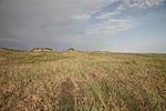
该段长城墙体起自第0215点,止于第0217点,全长3340米。该段所在区域为红柳沙丘地带和盐碱地草滩,受沙丘湮埋和盐碱侵蚀,墙体地面痕迹消失无存。在该消失段650米处南侧的红柳沙丘地带中残存有大石疙瘩墩(烽火台),1830米处南侧红柳沙丘地带中残存有小石疙瘩墩(烽火台)。
与相邻墙体和其他遗存的平面位置:该段墙体东与二墩滩长城3段相接,西与毕家滩长城1段相连,在该消失段650米处南侧的红柳沙丘地带中残存有大石疙瘩墩(烽火台),1830米处南侧红柳沙丘地带中残存有小石疙瘩墩(烽火台)。
现状:
Type:消失的长城 Disappeared wall
Protection Level:
Content:
Memo:
Other Records:
Distribution:
visit location in Tianditu Map[recommend] Distribution:
visit location in Tencent QQ Map Distribution:
visit location in Google MapDistribution:
visit location in Baidu MapNational ID:620981382301040011
Action:[
 Save in Data Basket
 ]
Picture:
Click the thumbnail to view the Big Pic. Click the Big Pic to Hide the Big Pic![Caption:二墩滩长城3段
loading images --Please wait...]() Photo Links
Photo Links:
 Search ::
  Favorite/My Favorite :: Recent Changes :: :: Login